SiteiQ – A Technology-Driven Tool to Aid Site Analysis
By Emma Chown
Date
April 16, 2019When designing a project it is critical to understand not only the site itself, but its local surroundings. Where are the site access points? How far away is the nearest school? What is the existing road hierarchy around the site? To help answer these questions accurately and efficiently, many design professionals turn to spatial data. Whilst the concept itself is nothing new, the methods for presenting and collecting this spatial data are changing rapidly.
When undertaking site analysis for a project, the traditional workflow is to create a series of paper plans that show the constraints and opportunities of the site. These plans are then utilised during the site visit and are marked up with additional relevant information. While this is a perfectly acceptable process for site analysis, paper plans have several limitations:
- Difficult to show detailed or elaborate information associated with the site;
- Cumbersome and time-consuming to produce;
- Static and cannot be updated in real-time, limiting collaboration;
- Can be challenging to orientate yourself during a site visit using the plan; and
- New site visit data must be manually converted to spatial data for future use.
The Changing Future of Site Visits
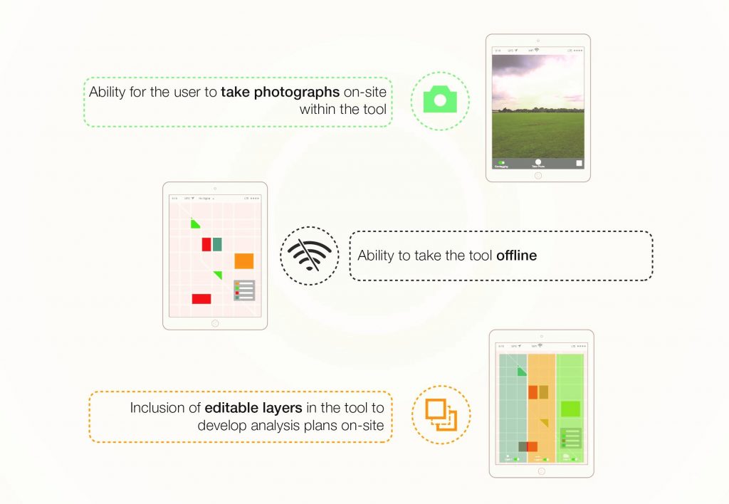
Technology is transforming all aspects of the way we work and site analysis is no exception. The advance of digital tools mean that designers can now use a tablet or smart phone to display information on site, replacing the need for paper plans. The functionality of digital tools far surpasses that of the traditional method. Using interactive maps users can pan and zoom around the area of interest and learn more information about the site by clicking on certain features. Users also have the ability to collect and update spatial data in real time during their site visit. Unlike paper plans, data collected using these tools is inherently spatial, and can easily sync to online maps making collaboration easier within the project team.

Digital site analysis tools provide users with flexibility that far surpasses the traditional paper method. Click here to view larger image.
In-House Solutions
SiteiQ, an idea developed through IBI Group’s Pocket R&D initiative, utilises technology to streamline the site analysis process. The tool allows users to review relevant constraint information ahead of the site visit using an interactive map. This information can be queried and interrogated to learn more.
Using a hand-held device with GPS (e.g. a tablet or smart phone) this interactive tool can be taken out into the field where users can review constraint data, collect relevant information, take photos, and begin to design on site. SiteiQ also has the ability to geolocate the user within the site so they know exactly where they are.

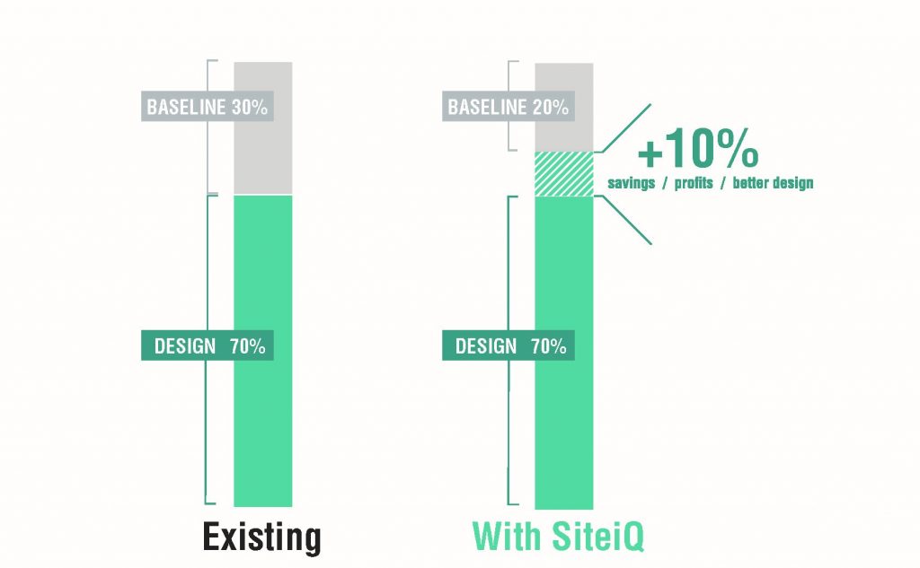
SiteiQ offers a 10% savings in total project time. Click here to view larger image.
Any data collected during the site visit can then be synced to secure web maps that the rest of the project team will be able to access instantaneously.
Future adaptations and advancements to SiteiQ could include the ability to measure changes in altitude on a site visit, the inclusion of local land sales and values, and the use of Augmented and Virtual Reality within the tool.
Tools like SiteiQ add real value to a design project by streamlining its baseline stage, and creating time and budget efficiencies.
Based on a review of ten masterplanning and architectural commissions in our Manchester, UK office we discovered that an average of 30% of total project time is spent on the baseline stage. SiteiQ could potentially reduce the baseline stage to 20% of the total project time. This 10% saving could free up time for the design team and increase our bottom line, showcasing SiteiQ as an attractive innovation for site analysis.
This article is based on the findings of “SiteiQ“, an internal Pocket R&D report by Emma Chown, Rachel Hutchins, and Mark Graham. Pocket R&D is IBI’s tactical micro-research initiative that taps into the knowledge of our talent pool to inform how we can define the cities of tomorrow.
Emma is a consultant focusing on spatial data and mapping, supporting IBI Group’s broad portfolio of projects across the transport and urban development sectors. Her expertise in Spatial Intelligence includes data management, analysis and visualisation. She has applied this expertise to a range of projects including Travel Demand Management projects for Transport for London and Highways England, and Master planning projects both locally and internationally. Through IBI Group’s Pocket R&D Initiative she developed SiteiQ, a GIS based tool to assist site analysis in all of IBI Group’s practice areas, allowing users to comprehensively review a site, in situ, by means of geolocation, photography and constraint information. As Regional GIS lead for our International Offices Emma creates and coordinates a range of global GIS initiatives. These aim to promote and increase the use of Spatial Intelligence across the firm and bring together GIS professionals throughout the company.


